BC Highway 99 – Road Conditions including the Whistler to Lillooet Weather and Sea to Sky Highway Road Condition Cams
Travelling South on Highway 99 – Check out the – Highway 99 Peace Arch Border Cameras
Highway 99 Whistler Village Weather and Road Condition Cameras
Highway 99 Cams – Lions Bay to Whistler
For the Whistler to Lillooet Cameras see the right sidebar or for mobile uses these cameras will show at the bottom of the page.
| Highway 99, southbound. Utility work between Exit 26 and Exit 20 for 4.7 km (Delta). Until Sat Nov 7 at 11:45 PM PST. minor construction | last updated Mon Feb 2 at 10:31 AM PST. |
| Highway 99, in both directions. Special event planned between W Pender St and Stanley Park Dr for 3.0 km (Vancouver). Starting Sun Apr 19 at 7:00 AM PST until Sun Apr 19 at 12:00 PM PST. Roadway will be reduced to two lanes. Expect delays. minor special event | last updated Wed Jan 14 at 2:28 PM PST. |
| Highway 99, southbound. Maintenance between Exit 28 and 72 St for 3.1 km (Delta). Until Tue Jun 30. From 10:00 PM to 5:30 AM PST daily. Environmental borehole drilling and soil sampling. minor construction | last updated Thu Jan 15 at 4:23 PM PST. |
| Highway 99, in both directions. Maintenance between Exit 28 and Exit 32: Steveston Hwy for 3.7 km (Delta to Richmond). Until Fri May 1 at 7:00 PM PST. Watch for traffic control. Tree clearing work. minor construction | last updated Fri Feb 20 at 3:21 PM PST. |
| Highway 99, southbound. Utility work planned between Nicklaus North Blvd and Blackcomb Way (Whistler). Starting Tue Apr 21 until Tue Apr 28 at 5:00 PM PDT. From 9:00 AM to 5:00 PM PDT on weekdays. Right lane will be closed. minor construction | last updated Mon Apr 13 at 12:26 PM PDT. |
| Highway 99, northbound. Construction work between Deas Thruway and Exit 32: Steveston Hwy (Richmond). Until Tue Apr 21 at 5:30 AM PDT. From 10:00 PM to 5:30 AM PDT on Monday. Ramp blocked. Eastbound right turn closure with a detour. minor construction | last updated Fri Apr 10 at 9:53 AM PDT. |
| Highway 99, northbound. Construction work planned between Deas Thruway and Exit 32: Steveston Hwy (Richmond). Starting Mon Apr 20 at 10:00 PM PDT until Wed Apr 22 at 5:30 AM PDT. Right lane will be blocked. Eastbound right turn closure with a detour. minor construction | last updated Fri Apr 10 at 9:57 AM PDT. |
| Highway 99, northbound. Construction work planned between Deas Thruway and Exit 32: Steveston Hwy (Richmond). Starting Wed Apr 22 at 10:00 PM PDT until Fri Apr 24 at 5:30 AM PDT. Left lane will be blocked. minor construction | last updated Fri Apr 10 at 10:01 AM PDT. |
| Highway 99, southbound. Construction work planned between Exit 32: Steveston Hwy and Exit 28 for 3.1 km (Delta to Richmond). Starting Fri Apr 24 at 10:00 PM PDT until Sat May 2 at 5:30 AM PDT. Right lane will be blocked. minor construction | last updated Fri Apr 10 at 10:04 AM PDT. |
| Highway 99, southbound. Shoulder maintenance planned between 72 St and Exit 20 for 0.9 km (Delta). Starting Mon Apr 20 at 6:00 AM PDT until Mon Apr 20 at 1:00 PM PDT. HOV lane will be closed. Watch for traffic control personnel. Bus / Hov closed for maintenance watch for traffic control and crews on scene. minor construction | last updated Fri Apr 17 at 2:32 PM PDT. |
| Highway 99, in both directions. Utility work planned between Copper Dr and Darrell Bay Rd for 7.2 km (Squamish). Starting Mon May 4 until Sun Jun 7. From 8:00 AM to 4:00 PM PDT on weekdays. Watch for traffic control personnel. Expect delays. minor construction | last updated Wed Apr 15 at 4:33 PM PDT. |
| Highway 99. Watch for slippery sections between Lil'wat Pl and Seton Lake Rd for 45.1 km (Lillooet). minor road condition | last updated Sat Apr 18 at 2:24 AM PDT. |
| Highway 99, in both directions. Electrical maintenance planned between Exit 28 and Exit 32: Steveston Hwy for 3.7 km (Richmond to Delta). Starting Sun Apr 19 at 1:00 AM PDT until Sun Apr 19 at 5:00 AM PDT. Lane Closure. Watch for traffic control personnel. minor construction | last updated Thu Apr 16 at 1:32 PM PDT. |
| Highway 99, southbound. Utility work planned between Lost Lagoon Rd and Gilford St for 0.3 km (Vancouver). Starting Fri Apr 24 at 10:00 AM PDT until Fri Apr 24 at 3:00 PM PDT. Right lane will be blocked. Watch for traffic control personnel. minor construction | last updated Fri Apr 17 at 10:19 AM PDT. |
| Highway 99, in both directions. Road sweeping planned between Lions Bay Ave and Porteau Cove for 12.8 km (10 km south of Squamish to Lions Bay). Starting Mon Apr 20 at 7:30 AM PDT until Tue Apr 21 at 5:30 PM PDT. From 7:30 AM to 5:30 PM PDT on Monday and Tuesday. Watch for traffic control personnel. minor construction | last updated Fri Apr 17 at 2:10 PM PDT. |
| Highway 99, northbound. Roadside brushing planned at Lions Bay Ave (Lions Bay). Starting Mon Apr 20 at 7:30 AM PDT until Tue Apr 21 at 5:30 PM PDT. Right lane will be blocked. Watch for traffic control personnel. minor construction | last updated Fri Apr 17 at 2:15 PM PDT. |
| Highway 99, in both directions. Maintenance planned between Exit 3: Horseshoe Bay Junction and Depot Rd for 50.0 km (West Vancouver to Squamish). Starting Mon Apr 20 at 7:30 AM PDT until Fri Apr 24 at 5:30 PM PDT. Watch for traffic control personnel. minor construction | last updated Fri Apr 17 at 2:17 PM PDT. |
| Highway 99, northbound. Bridge maintenance planned at Lions Gate Bridge (West Vancouver). Starting Sun Apr 19 at 10:00 PM PDT until Mon Apr 20 at 5:00 AM PDT. Right lane will be closed. Watch for traffic control personnel. Bridge washing will be taking place. The centre lane will be used for northbound traffic. minor construction | last updated Fri Apr 17 at 2:20 PM PDT. |
| Highway 99, southbound. Bridge maintenance planned at Lions Gate Bridge (West Vancouver). Starting Mon Apr 20 until Thu Apr 23. From 10:00 PM to 5:00 AM PDT on Monday, Tuesday, Wednesday and Thursday. Right lane will be closed. Watch for traffic control personnel. Bridge washing will be taking place. The centre lane will be used for southbound traffic. minor construction | last updated Fri Apr 17 at 2:22 PM PDT. |
| Highway 99. Utility work planned between Medicine Man Rd and Old Cariboo Rd for 25.6 km (44 to 70 km north of Lillooet). Starting Mon Apr 20 until Tue Apr 21. From 7:30 AM to 4:00 PM PDT on Monday and Tuesday. Watch for traffic control personnel. Vegetation management for BC Hydro. minor construction | last updated Fri Apr 17 at 2:56 PM PDT. |
| Highway 99, southbound. Road maintenance work planned between 72 St and Exit 20 for 0.6 km (Delta). Starting Sat Apr 18 at 7:00 AM PDT until Sat Apr 18 at 11:00 AM PDT. HOV lane will be closed. Watch for traffic control personnel. Hov lane closed watch for crews and equipment and traffic control. minor construction | last updated Fri Apr 17 at 5:29 PM PDT. |
Road Conditions Lillooet-Pioneer Road 40
For those travelling south – US Customs and Border
Keep up to date on Todays Closures for BC Highways
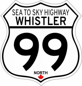
The “Sea to Sky Highway” is the title given to Highway 99 (Hwy99) from Horseshoe Bay to Pemberton. From Horseshoe Bay, the highway travels along the coast of Howe Sound.
From Horseshoe Bay it is 12 km (7.5 mi) to Lions Bay. North of Lions Bay the highway travels 21 km (13 mi), crossing into the Squamish-Lillooet Regional District to Britannia Beach.
Leaving Britannia Beach the highway goes north for 11 km (6.8 mi) to Squamish, at the head of Howe Sound.
58 km (36 mi) north of Squamish, the highway enters the popular Village of Whistler.
North of Whistler it’s on to Pemberton, where the Sea-to-Sky Highway ends and Duffey Lake Road begins.
Here is an interesting Video we found Vancouver to Squamish by Freeway Brent