BC Mountain Pass Cameras News – Check out the summit with images from the DriveBC Cameras
The BC Mountain Highway Passes are a network of mountain passes in British Columbia, Canada that are used for transportation purposes. The mountain passes are located in the Coast and Rocky Mountain ranges of British Columbia and are used by both commercial and recreational vehicles. Some of the more well-known mountain passes in British Columbia include the Coquihalla Highway, the Okanagan Connector, and the Crowsnest Highway. These mountain passes can be prone to challenging driving conditions, especially in the winter months, due to heavy snowfall and ice. As a result, it is important for drivers to be prepared and to check the road conditions before setting out on a trip through the mountain passes.
Snow Tires vs. All Season Tires – Which ones do you need?
Drive BC Webcams Hwy 1
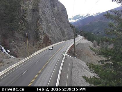
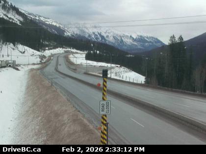
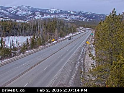
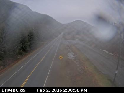
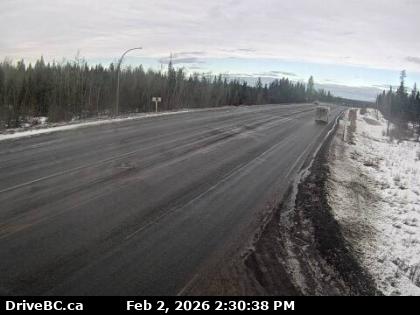
Hwy 1 – Jackass Mountain Summit
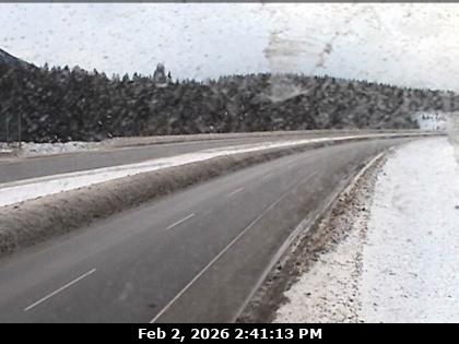
All Highway 1 Road Condition Reports and Cameras
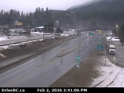
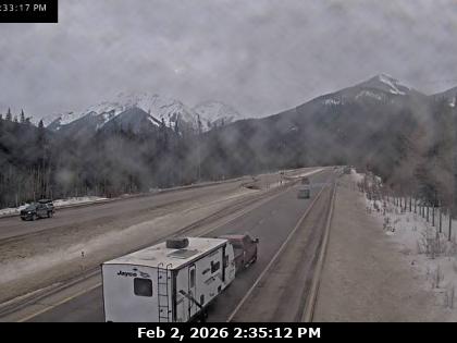
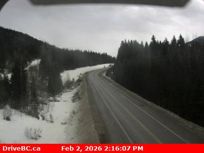
Hwy 1 – Revelstoke
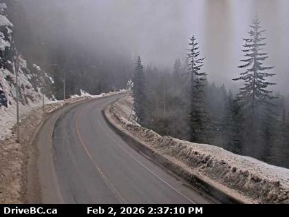
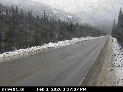
Hwy 1 – Jack McDonald Snowshed
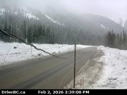
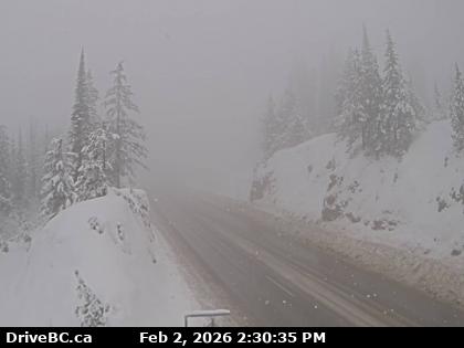
Hwy 1 – Rogers Pass
Hwy 1 – Kicking Horse Canyon
Highway 1 Road Condition Reports today
Hwy 1 – Lake Louise
Hwy 1 – Banff Alberta
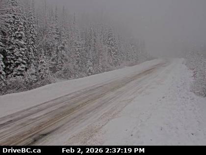
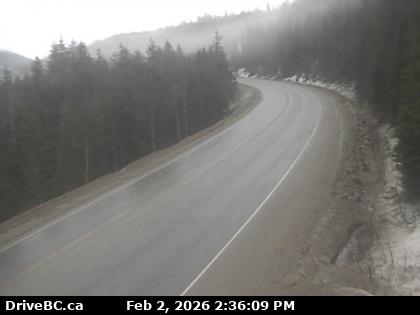
Drive BC Webcams Highway 3
All BC Highway 3 Road Condition Reports and Cameras
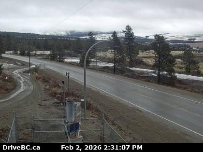
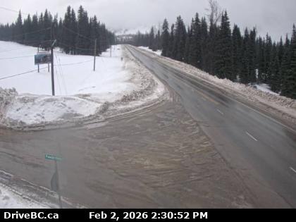
Hwy 3 – Allison Pass
Highway 3 Hope to Princeton Cams
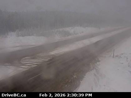
Hwy 3 – Sunday Summit
Hwy 3 – Anarchist – West of Summit
Hwy 3 – Eholt Summit
Hwy 3 – Paulson Summit BC Mountain Pass Cameras
Highway 3 Osoyoos to Salmo Cams
Drive BC Webcams Hwy 3b
Hwy 3b – Strawberry Pass
Highway 3B Road Conditions and Weather Cams
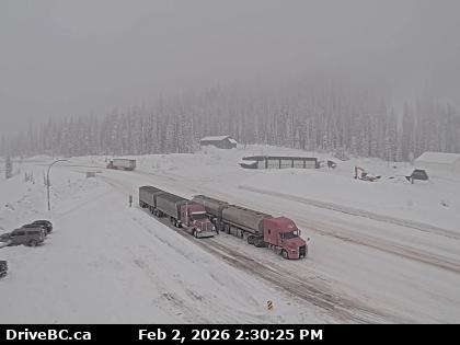
Drive BC Webcams Hwy 5
Coquihalla Highway Route Webcams
Hwy 5 – Messiter Summit and Hwy 5 Cams
Drive BC Webcams Hwy 6

Hwy 6 – Monashee Pass
Drive BC Webcams Hwy 16
Highway 16 Terrace Through Rainbow Summit
Hwy 16 – Rainbow Summit
Highway 16 Road Condition Reports and Cameras
check out the summit – bc mountain pass webcam news
Drive BC Webcams Hwy 20
Drive BC Webcams Hwy 24
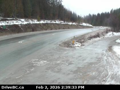
Hwy 24 – McDonald Summit
Drive BC Webcams Hwy 97
Hwy 97 – Begbie Summit
BC Highway 97 Road Condition Reports
All Road Conditions for BC Highway 97
Drive BC Webcams Hwy 97c
Hwy 97c – Pennask Summit
Highway 97C Conditions and Weather Cams
Interesting Ham Radio Link to BC Summits on the Air
Drive Safely on Mountain Roads – BC Mountain Pass Webcams DriveBC Cameras
Driving in the mountains is different from city and highway driving. There are the added rise and decline in elevation, narrowing and winding roadways, and the ever-present possibility of snow and ice. We’ve put together some tips to help you safely navigate your way over the mountains, regardless of the time of year.
Watch the Weather Forecast and Check the Road Reports
If the passes seem too treacherous for you, wait it out. Weather conditions can change overnight.
Fill up your gas tank before you leave. Driving up and down mountain passes at slower speeds can burn a lot more fuel than regular driving. In addition, check your defroster, wiper blades, and headlights and top-off all your fluids, including wiper fluid and antifreeze.
It’s not how you drive, but how you arrive that matters. Slowing down on snow and ice-covered mountain roads is the best way to reach your destination without getting in an accident or losing control.
Leave early and give yourself plenty of time. There’s enough stress with driving in winter conditions, you don’t need to add to it feeling rushed.
Avoid using cruise control. Your tires could spin too fast on snow and ice, reducing your control.
Maintain a safe distance. It takes a lot longer to stop on ice and snow.
Ease up on the gas. Slow acceleration and easing off the gas can help keep you in control.
Shift down instead of constantly braking. If you drive an automatic, use your vehicle’s lower gear settings. Keeping your vehicle in a single gear can help improve traction. Plus it ensures you maintain a slow speed.
Don’t pass unless it’s absolutely necessary. Again, the best way to get there without incident is to slow down.
Don’t hug the centreline. If you skid or lose control, you don’t want to drift into oncoming traffic.
Invest in a set of good winter tires. DriveBC Cameras Vintage Car Tours Vancouver and BC
Safety Tips for Driving Mountain Passes